
The beautiful passes in Vietnam are ecstatic, go hundreds of times without getting bored
Exploring the beautiful passes in Vietnam is an opportunity for visitors to have great experiences, to
Although considered as dangerous roads, the obsession of long-distance drivers, but the passes below always attract visitors by their wild and magnificent beauty. You love to discover new things, conquer precious moments. It is definitely impossible to ignore the most beautiful and dangerous passes in Vietnam. Along with tourist destinations, the passes always attract Vietnamese people. If you like to learn new things, like to experience and conquer. Put these beautiful and dangerous passes below into your backpacking list.
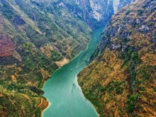
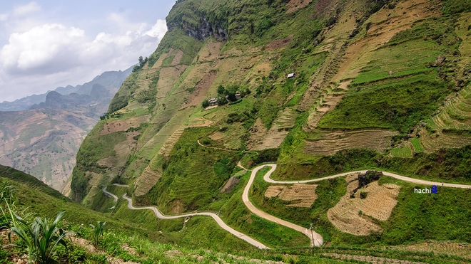
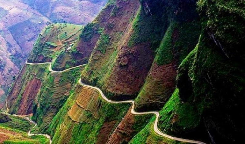
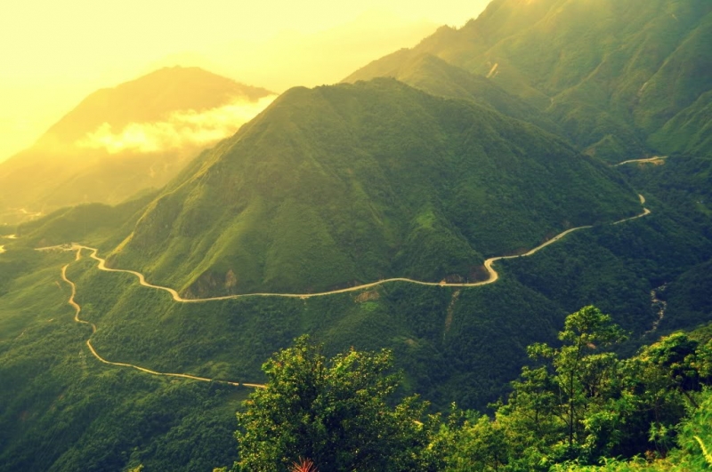
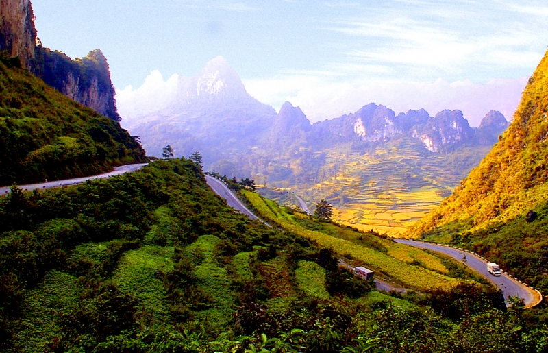
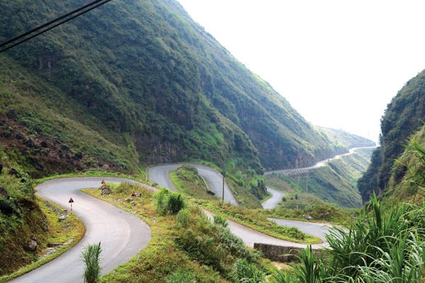
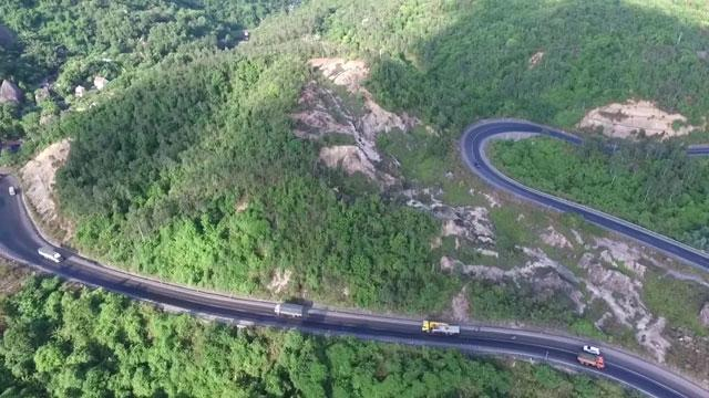
Ma Pi Leng Pass is a pass road about 20km long, located on the Hanh Phuc road connecting Ha Giang city to Dong Van, Meo Vac. More than 1200m above sea level, Ma Pi Leng is like a meandering silk strip, gliding along the mountainside with deep abysses, which is a great challenge for those who love adventure travel. From afar, the pass looks like it’s split in two, one side is the top of Ma Pi Leng, the other is Sam Pun (Sam Pun) – where there is a border marker and the border gate to Dien Bong, China.
Ma Pi Leng in the Quan Hoa language refers to “the bridge of the horse’s nose” literally, broadly describing the craziness of the mountain top, where the slope is so high that even the horse passing through must die, or the top of the mountain stands upright. like the bridge of a horse’s nose. Although Ma Pi Leng Pass is not long, it is the most dangerous road in the Northern mountains and is likened to the “king” of Vietnamese passes. Contrary to the majestic beauty is the danger that always lurks for the driver every time he turns the corner. The danger from the fog, the narrow zigzag road plus the sleeve bends make it very difficult for cars going in the opposite direction to avoid each other.
To make this road, tens of thousands of workers from all over the Northern provinces worked hard day and night chiseling stones, especially in the passage through Ma Pi Leng, the young men hung themselves on the cliff and encroached every centimeter to build the road in 11 days. month. The pass was originally opened for pedestrians and lorries only, later it was widened to accommodate rough vehicles, but it was still very dangerous because of the sleeve bends. After completion, Ma Pi Leng pass with 9 bends on the steep cliffs, below is the abyss.
With rugged terrain and spectacular unspoiled landscape, Ma Pi Leng’s pass on Ha Giang plateau is one of the four great peaks of the Northwest mountains.
Pha Din Pass is also known as Pha Din slope, connecting the two provinces of Son La – Dien Bien, famous from the Dien Bien Phu campaign because it suffered thousands of tons of bombs and bullets but still survived. The name Pha Din pass comes from the Thai ethnic language “Pha Din”, in which Pha means heaven, Din means earth, implying here is the confluence between heaven and earth.
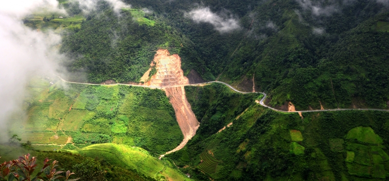
Looking down from the top of the pass, Pha Din appears a very dangerous and precarious terrain, a thin road crisscrossing between a cliff on one side and a deep abyss on the other. The slope of the pass is about 10%, in some places 12% to 15%, even there are local uphill bends of 19%. When going uphill and downhill, the long zigzag road with 8 extremely dangerous races, the radius of the curve is less than 15m and besides, there are countless sleeve bends, A and Z turns in which there are many curves. Many sections are just enough for one car to pass. A dangerous element of Pha Din is that it is located on the red soil mountain area. Not a limestone mountain like other famous roads, so the ground is relatively weak, prone to landslides in the rainy season.
In 2005, the government decided to invest in upgrading the National Highway 6 in the Northwest. In particular, the section Son La – Tuan Giao was built from 2006 to 2009 and completed, dividing Pha Din pass into two old and new routes on the fork of the pass. The old Pha Din pass is 32km long (from km 360 to km 392 located on the old national highway 6), the highest point is 1648 m above sea level and about 125 famous dangerous bends, narrow roads, many sections are just enough. let a car pass. The new Pha Din Pass was built along the mountainside to the left of the old National Highway 6. The length is reduced to 26km with about 60 bends, some bends are up to 60m wide, the slope is reduced to 8%, especially the road surface is 2 times wider than before.
Since the new Pha Din Pass route has been put into use, it has made traffic safer, while the old Pha Din Pass is only suitable for locals or adventurous tourists to conquer and explore. .
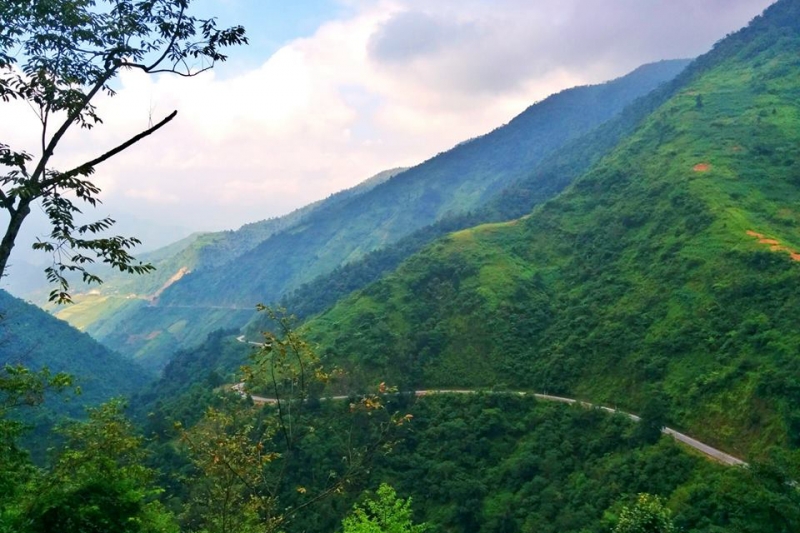
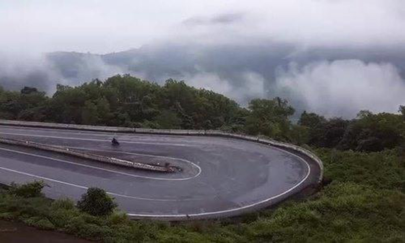
O Quy Ho Pass has a long zigzag road on Highway 4B. Of which, 2/3 of the distance is in Tam Duong and Lai Chau districts, the remaining 1/3 is in Sa Pa and Lao Cai. This is probably a pass that holds the record for length in the Northwest mountains – Vietnam with a length of up to nearly 50km. The top of O Quy Ho’s pass in the middle of the mountains is also known as the Heaven Gate.
When winter comes, the top of O Quy Ho pass can be covered with snow and ice. O Quy Ho Pass is also known as Hoang Lien Son Pass or May Pass, which cuts across the Hoang Lien Son range.
This pass route is now well upgraded, becoming a more frequent traffic route. However, with one side being a deep abyss and the other side being a steep cliff, the pass is winding and winding, up and down continuously according to the concordance of the mountain range, this famous pass will make the pass the conqueror has the phase of downhill, cut the crab “pale”. It only takes a second of carelessness and both people and vehicles will plunge into the abyss below. The most dangerous part is that the “sleeve crab” section of the abyss is very difficult to go.
To ensure safety, it is best to go by motorbike or car during the day, do not go at night when visibility is limited, and always keep a moderate speed to handle all possible contingencies. happening.
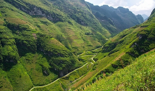
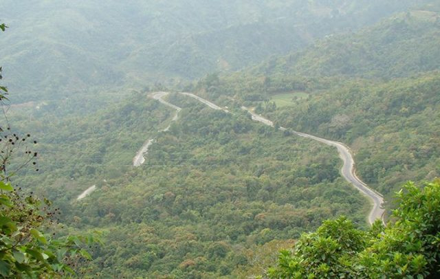
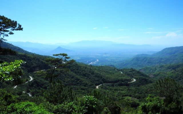
Khau Pha Pass is located on Highway 32, with the starting point being the section of Highway 32 with Highway 279 with a length of over 30km. Located in the bordering area between Van Chan and Mu Cang Chai districts, Yen Bai province and passing through many other famous places such as La Pan Tan, Tu Le, Che Nha, Nam Co… from Yen Bai city vice versa. Following Highway 32 for about 5 hours through Tu Le commune, Khau Pha pass, Mu Cang Chai district will appear in the middle of a plateau surrounded by mountain ranges.
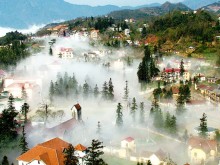
Because it is located at an altitude of more than 1200m above sea level, the temperature is quite low, so the top of Khau Pha pass is often cloudy. The pass road is dangerous, winding, crisscrossing mountains.
Khau Pha Pass is one of the most winding and steep passes in Vietnam, passing the top of Khau Pha mountain, the highest mountain in the Mu Cang Chai region.
During the length of the pass, there are dozens of bends and turns. On cloudy days, Khau Pha Pass becomes extremely dangerous for drivers because visibility is limited. In addition, there is the danger lurking from the rocks from the high mountains that can fall in bad weather conditions.
Visitors to Cao Bang, if they want to visit Ban Gioc waterfall, Nguom Ngao cave (Chong Khanh district) or visit Ta Lung international border gate (Phuc Hoa district), visit the prosperous town of Quang Uyen (Quang Uyen district). .. have to go through Ma Phuc pass.
The pass is about 20km east of Cao Bang city, in the territory of Quoc Toan Commune, Tra Linh district. Although the pass is quite dangerous, there are many beautiful scenes. Ma Phuc Pass is about 3.5km long; about 700m above sea level. It meanders along the limestone mountainside.
From the foot of the pass to the top of the pass, there are 7 steep slopes. On one side of the pass is a towering cliff, on the other is a deep abyss with narrow ravines. Ma Phuc Pass is a unique road, the gateway to the eastern districts of Cao Bang province.
Although Ma Phuc Pass is not as dangerous as O Quy Ho or Ma Pi Leng, it also makes those who are not familiar with this road also afraid in the first time passing.
Thung Khe Pass belongs to National Highway 6, Hoa Binh province, located between Tan Lac and Mai Chau. Reach the middle of Thung Khe pass at an altitude of 1000m above sea level. There are a few rows of leaf-roofed shops, which are tables assembled from shaggy trees on the side of the road, selling sugar cane, bamboo rice, stone moss, and wild vegetables. You can stop to enjoy boiled corn, boiled sugarcane, and eat attractive and attractive Lam Lam rice with sesame seeds.
The pass is not as majestic as O Quy Ho in Lao Cai, not as steep as Ma Pi Leng in Ha Giang, but contains countless unexpected dangers for any driver.
Thung Khe Pass does not have the bends of the sleeve-like the pass roads in Ha Giang or Lai Chau, Dien Bien, but it is dangerous because of the dense fog every afternoon, whether it is winter or summer. Especially crossing Thung Khe Pass in the winter evening, an unforgettable experience for any driver, with thick fog and numbing cold, cloudy vision, only the lights of the car are as bright as a painting. on smoke trails…
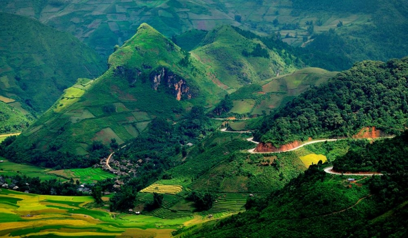
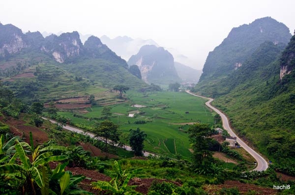
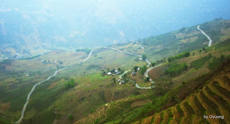
Ha Giang, where the first drawing on the map of Vietnam is located, captivates backpackers with its majestic winding roads. Bac Sum Pass is likened to Pha Din Pass, one of the four great peaks of Vietnam’s pass. If you have the opportunity to explore Ha Giang, don’t forget the Bac Sum pass !
Bac Sum Pass is located between Vi Sum and Quan Ba, winding and zigzagging bringing visitors to the journey to discover Dong Van rock plateau. Bac Sum Pass is located on the section of Highway 4C from Ha Giang city to Tam Son town, Quan Ba district. Bac Sum slope starts from Tan Son bridge on Ban Thang stream in Tan Son village, Minh Tan commune, Vi Xuyen to the boundary of Minh Tan and Vi Xuyen communes with Quyet Tien commune, Quan Ba district.
Looking down from here, you will see the winding path and precarious houses on the high mountains. Belonging to Ha Giang province, Bac Sum pass is mentioned by backpackers as the second Pha Din pass of the North. The pass stands out with small, winding, zigzag roads that will bring adventurers a very interesting feeling.
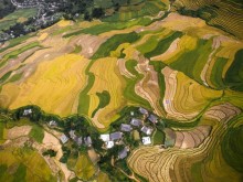
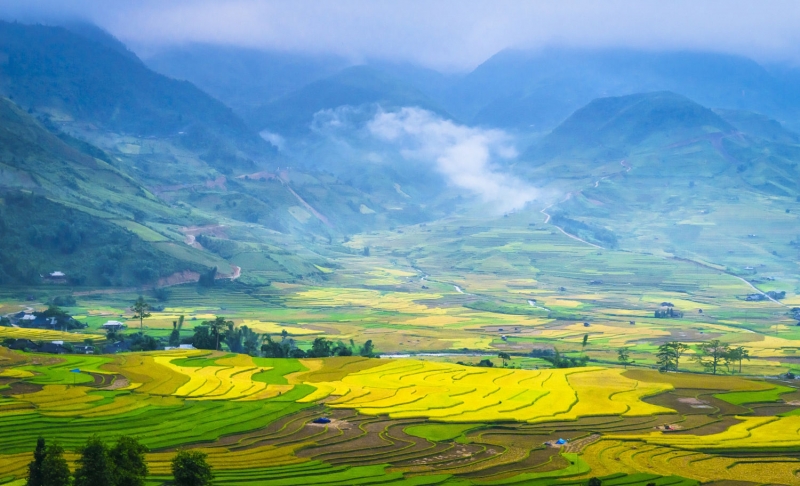
In the green or ripe rice season, Tam Son valley floating in blue-gold adorns the fairy mountains, becoming more and more sweet and charming. When the season of autumn fog fades, winter comes, two hidden mountains are floating, making visitors feel uneasy. Through 4 seasons, from this stretch of road like a silk strip crossing this mountain, one can “catch the pulse” for Co Tien’s health because the color change appears from these 2 forbidden fruits. Bac Sum Pass is an interesting place to explore when traveling to Ha Giang, which many tourists come and admire with the majestic natural scenery of mountains and forests, immense between heaven and earth.
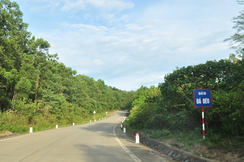
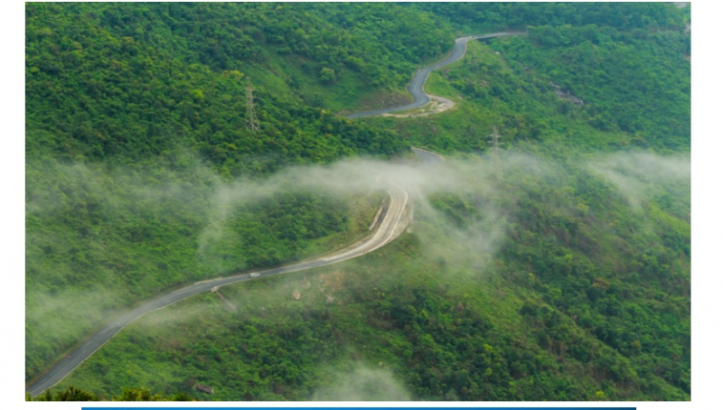
From Dong Hoi, follow the Ho Chi Minh road to the hewn rock pass for about 100km, which is paved with flat asphalt. The pass is 17km long, located in Thuong Hoa commune, Minh Hoa district, Quang Binh province with bends of sleeves and primeval old forest.
Da Deo Pass is the most dangerous road along the East Truong Son section of Ho Chi Minh road. It is also because of the winding slopes, through many steep streams and streams, and the soft ground has many potential risks of causing traffic accidents. The roadbeds of these sections all pass through complex geological areas, often with groundwater and landslides. In just 1 year, at Km 919+200 – Km 919+900 on Ho Chi Minh road through Da Deo pass (Minh Hoa – Quang Binh), 4 serious traffic accidents occurred. According to the police of Minh Hoa district, the cause of traffic accidents in the steep corner at the top of Da Deo pass all comes from driving downhill at high speed when encountering a sudden bend, did not control the leading speed. to the accident.
To ensure traffic safety for people and vehicles when passing through here, the Directorate for Roads of Vietnam has invested in funding to handle these black spots. The plan proposed by the authorities is to make a speed reducer on the road surface to warn vehicles to slow down before going downhill and to tarp the roof and build a refuge road for vehicles to enter when they are hit. sudden brake loss
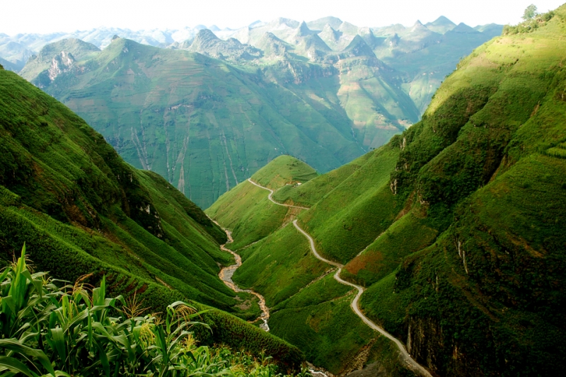
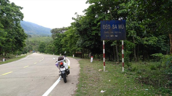
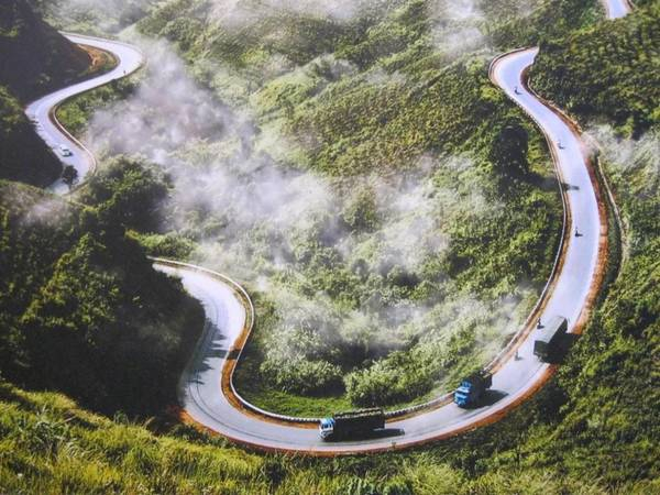
Sa Mu pass is located in the northwest of Quang Tri province, connecting the two communes of Huong Phung and Huong Viet of Huong Hoa district, Quang Binh province. The pass has an altitude of nearly 1400m above sea level bordering Vietnam – Laos. The pass is named Sa Mu because the pass here is covered with white clouds with a length of nearly 20km. This is the ideal road for backpackers to admire the beauty of the mountains and forests and explore the most dangerous pass in the Northwest, Quang.
To get to Sa Mu pass , depart from Khe Sanh town along Ho Chi Minh road about 35 km to the foot of the pass. Looking from here, visitors will see the winding road, winding like a “dragon” sleeping, among the high clouds. Although in the summer, western Quang Tri is affected by the hot, dry Lao wind, but at the top of the pass the air is still quite cold. In this season, Sa Mu road is even more beautiful when traveling through many steep and winding slopes with a layer of fog covering the mountain pass. Experiencing “a little dust”, watching the majestic Truong Son mountain range, once a heroic hero in the war will be an interesting gift for backpackers.
The pass is also associated with the glorious and heroic years of fighting against the US because Sa Mu – Khe Sanh has a dangerous terrain, a land associated with the most fierce and historical battles. Local people here recounted that in the past, soldiers transporting weapons and food inside had to go around the land of Laos about 30 km because the pass was too high, dangerous, many steep, winding, very steep. hard to go through.
Try once to come here, visitors will feel the “taste”, the “intersection” between the earth and the sky, because no matter what time you go, the fog always covers the trees, hovering. The white of the dew, the green of the trees, the red of the earth and the gray of the road create an overall harmonious natural color that makes a strong visual impression on the viewer.
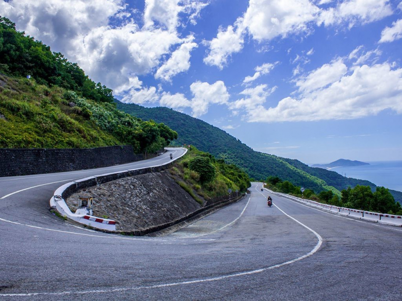
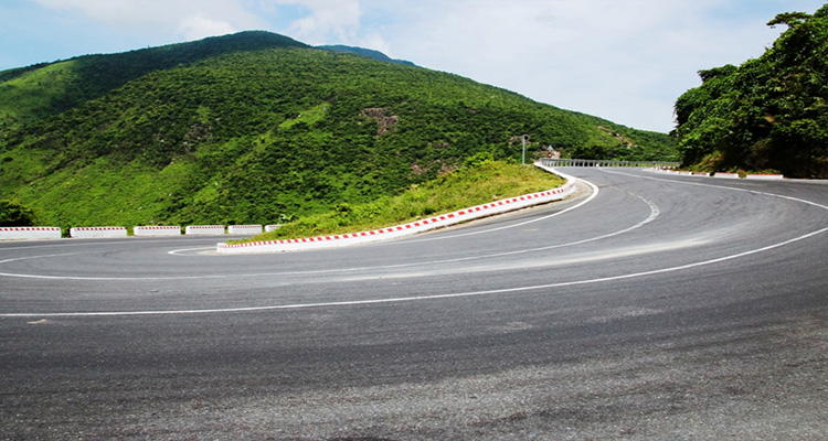
Liked as “the most majestic landscape in the world”, Hai Van pass is located on the Bach Ma mountain range and is the natural boundary between Thua Thien – Hue province and Da Nang city. With a length of 21km, the highest peak is nearly 500m high and is the most famous and dangerous pass. Before, when there was no road tunnel through the pass, Hai Van Pass was always busy with traffic. Today, Hai Van Pass has a quiet and poetic beauty, always welcoming the unexpected discoveries of many tourists who love new experiences.
Despite the rugged and precarious terrain with steep slopes and meandering mountains, any visitor who has the opportunity to set foot here is extremely attracted by the beauty of one of the roads. The most beautiful mountain pass in the world. Hai Van Quan is a short stop on the way to conquer Hai Van Pass. This is not only a stop for visitors to admire the “charming water” natural landscape, but it also has ancient architectural beauty associated with many historical imprints.
Conquering Hai Van PassBy bicycle or bicycle, visitors will have a great feeling when leaning over every bend, nervousness when going downhill, even goosebumps if traveling in rainy, windy, foggy weather. But on the contrary, experiencing Hai Van pass by train is also an interesting thing! The boat glides around, hugging the crabs into the cliffs, crossing the mountains hidden in the clouds, sitting on the boat, visitors can zoom out, you will enjoy admiring the picture of mountains, sea, clouds and sky.
Hai Van Pass not only attracts visitors by the adventurous winding, the majestic Hai Van Quan pass, but also captivates the hearts of many tourists from all over the world by the romantic love when guests arrive at the Don Ca arch (located in the foot of Hai Van pass). Once you have come here, you will be surprised like entering another world, peace, quiet, freedom to immerse yourself in the sun, wind and clouds.
Ca Pass is one of the largest and most dangerous passes in the Central region. On one side of the pass is a deep abyss close to the sea, and on the other side is hills and mountains that overlap with dangerous cliffs. The climate is cool all year round, from here you can go to other tourist destinations. The pass is 333 m high, 12 km long, crossing Dai Lanh mountain range at the border of two provinces of Phu Yen (Dong Hoa district) and Khanh Hoa (Van Ninh district), on National Highway 1A.
Historically, this place used to be the boundary between Dai Viet and Champa, when King Le entered the South, he had to stop at Deo Ca because the difficult terrain did not allow him to continue. He built a small base in Phu Yen named Hoa Anh. During the period from the 15th to the 16th century, this place was the boundary of the hot spot where many skirmishes occurred between Dai Viet and Champa. Not only that, in the late 18th century and early 19th century, this place was a historical place marking the wars between Nguyen Anh and the Nhac – Lu – Hue brothers. Ca Pass deserves to be a famous historical place because it has witnessed many ups and downs of the times. In 1947, Deo Ca continued to witness many skirmishes between the French colonial army and the Viet Minh Front.
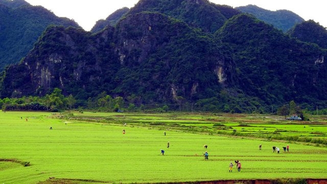
Deo Ca’s climate is favorable for many tree species to grow, green mountains, and fresh air. The flora here is rich and diverse, this is also the shelter of many animals such as pangolins, horse bears, leopards, porcupines, monkeys, star pheasants … in which there are specific species that only live here. in this area. The forest has many precious wood species: Sao, Cho, Oil, Vulture, Agarwood, Ca sling … creating a primeval scene. Standing on the top of Ca pass, you can zoom your eyes out to see a vast sky. A charming painting appears from the plains to the mountains, in the distance is the immense sea.
The road to the pass is winding like a silk strip between the green of the mountains and forests, there are bends that seem impossible to turn the steering wheel. Passing through the towering high rock formations, there is a feeling of the great grandeur of nature. The danger of Ca Pass seems to swallow anyone who wants to go through. Not only the majestic and dangerous scenes, Ca Pass is also very poetic with the space of a vibrant blue color, but the sky is also clear without a cloud, the wind flows through each finger to bring freshness and freshness. . Nature is beautiful as if to hold the footsteps of travelers, scenes of love, people who love scenes.
Located on Highway 26, connecting the two provinces of Khanh Hoa and Dak Lak, Phuong Hoang Pass is like a bird in the sky, bringing travelers to admire the beautiful sky and clouds. Phuong Hoang Pass is about 12km long, belongs to M’Drak district and is the eastern gateway of Dak Lak province. Phuong Hoang Pass is a place that was once considered a death pass because of its geographical location as well as the dangers that always lurk for travelers passing through this place. However, now, the pass has been widened and attracted many young people to explore.
Phuong Hoang Pass is a place that was once considered a death pass because of its geographical location as well as the dangers that always lurk for travelers passing through this place. Not only is the mountain road winding, but curving, this “bird wing” of Phoenix was also once a lair of bandits of the Central Highlands, making many people afraid. However, now, the pass has been widened, the scenery is beautiful, attracting many backpackers who want to see a wild beauty here. Phuong Hoang Pass challenges the driver with crooked sleeve turns, just being careless can be dangerous. However, the feeling of climbing the pass and looking at the past road like a beautiful phoenix spreading its wings winding along the mountainside makes the feeling of apprehension also give way to excitement.
On this pass, you can admire the beautiful scenery like a magnificent picture of the mountains and forests. And the winding roads and mountains at Phuong Hoang Pass make us feel closer to nature. Phuong Hoang Pass with majestic mountain scenery connects the coastal region with Dak Lak. The vast mountains and forests greet travelers with great waterfalls, the sound of streams and trees mingle with joy. Through the phoenix pass, the steady riders seem to be lost in the call of thousands of waterfalls and villages.
Crossing Phuong Hoang Pass up with Dak Lak mountains and forests, completely immersed in the majesty and wildness of this place will leave you with a great feeling. If you are familiar with the sea or smooth straight roads, why don’t you try to change the atmosphere with the “bird wings” of Phoenix with roaring waterfalls, high mountains, and simple ethnic people? huh!
Ngoan Muc Pass , also known as Krong Pha Pass (a place of Cham people still standing) Vietnamese people read it as Song Pha, the French call it Bellevue, is one of the most beautiful mountain passes in Vietnam in Ninh Thuan province. along the steep mountain slopes connecting Ninh Son valley with Lang Biang plateau.
The pass is 18.5 km long, with an average slope of over 9 degrees. Therefore, this is also the pass with the steepest slope in the southern provinces. Ngoan Muc Pass is one of the most majestic and beautiful passes in Vietnam. As the name suggests, the scene of Ngoan Muc Pass is zigzag and winding, with many twists and turns to cross the high mountains. The majestic and picturesque unspoiled landscape, both elegant and romantic, makes visitors’ hearts ecstatic. The road twists and turns continuously. At the height of 400m, you will have the opportunity to look back on the passage that has passed. On Ngoan Muc Pass, there are 4 very sharp elbow bends, the road gently curves through the hills, hillsides, large and small, forming a wavering, creating roads that if you have the opportunity to stop at the top, look down. , it is easy to see its romantic charm and grandeur.
Looking down from the pass, you can see the steep, deep cliff, peeking through the pine trees is a winding road with cars like slow toys crawling up or down. Farther is the Phan Rang plain with the winding Cai river. Two high mountain ranges embrace Phan Rang valley running to the sea. On beautiful days, from the top of the pass, you can see the white sandy shoreline and undulating waves. From Ngoan Muc pass , visitors can take in the view of the whole surrounding landscape created by nature into a harmonious picture, with streams and waterfalls cutting through the cliffs, mountains, and hills with quite rich flora. diverse and unique.
With a rather dangerous terrain, Ngoan Muc becomes an interesting road for backpackers on the way from the mountain town of Da Lat down to the sunny and windy coast of Phan Rang. If you have gone through many passes in Vietnam, you will see that Ngoan Muc is no longer an inanimate pass but a living entity with many states. For many travelers, it seems that every time passing through here, the wild nature and majestic mountains of Ngoan Muc bring many different feeling states.
Above are the top roads worth conquering in Vietnam – a great destination if you like to go backpacking and adventurous. Let the world know which road you are most impressed with by commenting below. Don’t forget to like and share the post if you find it interesting!
Photo: Internet