UK and Europe daily weather forecast latest January 23 Heavy snow to blanket across the UK with wintry conditions
The UK is forecasted to cope with heavy snow up to 20 inches with wintry conditions across the country.
Forecasters warn more severe cold snaps are on the way later this month, as cold air outbreaks move in from Scandinavia, Express reported. The weather front looks set to spark unsettled conditions, including plummeting temperatures and heavy snow across the whole country, according to the latest weather charts.
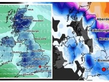
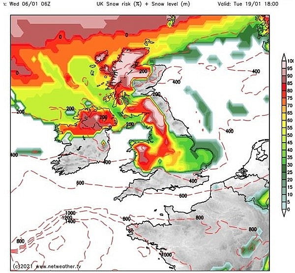
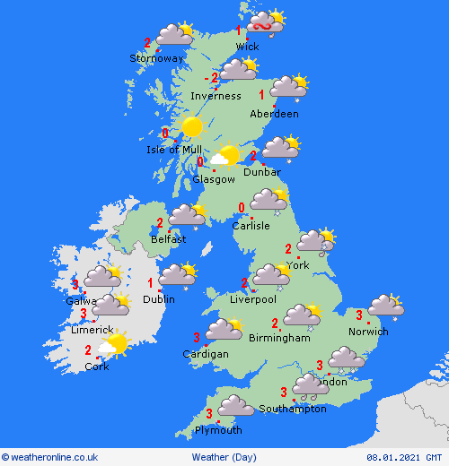
The wintry conditions are expected to hit the UK by Tuesday January 19, with a weather chart by Netweather showing snow is forecast for much of Britain.
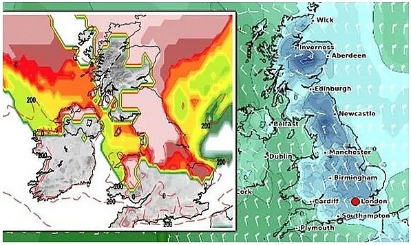
The map, valid for 6pm, shows much of Scotland and the north of England covered in patches of white and red, indicating between an 80-100 percent risk of snow.
Parts of Wales, Northern Ireland and the Midlands are also covered by the bright colours. The east of England has a moderate snow risk, as indicated by the yellow and green colourings.
By 6am the next morning the snow risk has increased significantly, with almost the entirety of Scotland, northern England and Wales showing a 100 percent risk of snow.
By 6pm the weather front moves further east, as the snow risk chart shows the whole of the south of England, including the capital, turn white indicating a 100 percent chance of snowfall.
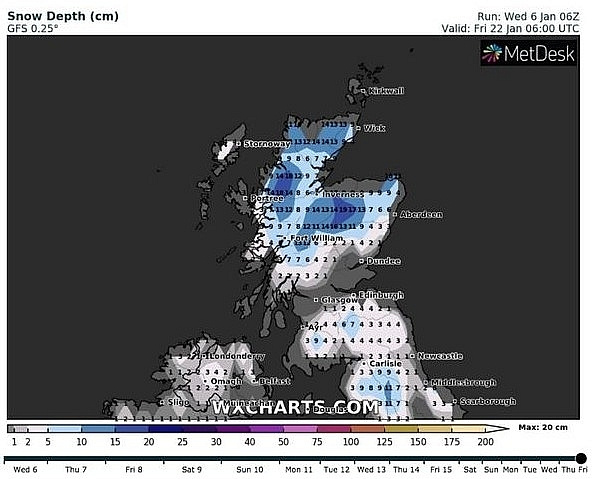
Weather charts also show Friday, January 22 is set to bear the brunt of the wintry conditions. Snow depth charts by WXCharts show parts of Scotland can expect 7.5inches (19cm) of snow by 6am, while the north of England is forecast to see up to 4.3inches (11cm).
Wales is expected to receive up to 3.5inches (9cm), with the south of England forecast to receive similar amounts of snow, according to the chart. Alongside the snowfall, temperatures are also forecast to plummet well below freezing.
A second weather map focusing on the minimum temperature by WXCharts forecasts the mercury could fall to as low as -12C in parts of Scotland at 6am on Friday January 22.
They said: “This boundary between the cold and milder conditions could also allow for some significant snowfall where the two air masses meet.”
BBC forecasters also expect the end of January to be hit by unsettled, wintry conditions.
They said: “Heading later into January there is a growing risk of some of these cold snaps become more widespread and longed-lived.”
“They are still expected to be the exception rather than the norm like we saw over the holiday break, but by late-January there is potential for some sharp cold snaps between fronts.”
Brian Gaze at the Weather Outlook also expects colder conditions to return at the end of the month.
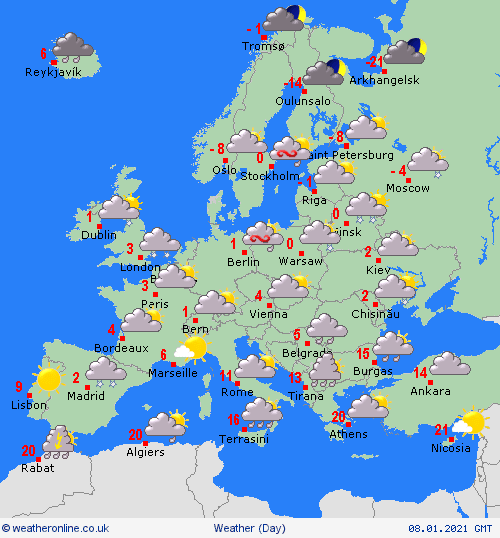
Heavy rain across eastern and southern Spain and Portugal with snow on the hills. More rain in the Balearics. Showers for Corsica and Sardinia as well as southern Italy. Northern Italy should be dry and fine. Greece will have sunshine and should be staying dry. A dry day too for Turkey with more sunshine to come here.
Fair for France but cold with sunshine. Showers in the Low Countries and northern Germany, these heavy and wintry. Fair in southern Germany. Poland will have sunny spells but some showers to the north. Hungary, Austria and Switzerland should all be fair with sunny spells. Coo, with wintry showers in Denmark. Cold for the Baltic States and Finland but mostly dry. Chilly too in Sweden with some showers in the east, fair for most areas. Norway will have some wintry showers on the coasts.
Heavy rain in southern and eastern parts of Spain. Bright and dry for northern and western Spain and Portugal. Rain too in the Balearics and Sardinia with dry weather in Corsica. Southern areas of Italy will be wet, although most of the rest of Italy will be dry with sunshine. Fair for Greece and Turkey with both countries seeing sunshine.
Some morning fog in France, slowly lifting to leave dry weather and sunny spells. Scattered showers in the Low Countries . Wintry showers for Germany. Poland will be dry with sunny spells. Hungary and Austria as well as Switzerland will be dry with more spells of sunshine here.